Elevate Your Travel Memories: The Ultimate Guide to Drone Photography
Introduction: The Aerial Perspective Revolution
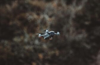
Drone photography has transformed how we capture and remember our travels. This revolutionary technology provides access to perspectives previously available only to helicopter pilots and those with substantial budgets. Today’s consumer drones combine high-resolution cameras with intuitive controls, enabling travelers to document destinations from breathtaking heights and unique angles that tell visual stories.
The fundamental appeal of drone photography lies in its ability to reveal patterns, textures, and relationships invisible from ground level. A coastline that appears ordinary from the beach becomes a striking interplay of turquoise waters and golden sand from 100 meters above. Ancient ruins that seem disconnected on foot reveal their architectural patterns and historical significance when captured from the air.
Whether you’re a seasoned photographer looking to expand your creative toolkit or a travel enthusiast wanting to document your journeys from new perspectives, this comprehensive guide will help you navigate the exciting world of drone photography.
Table of Contents
- Understanding Drone Photography: The Basics
- Essential Drone Equipment for Travelers
- Mastering Drone Photography Techniques
- Navigating Drone Regulations Worldwide
- Post-Processing Your Aerial Images
- Creative Compositions from Above
- Planning Your Drone Travel Photography
- Common Challenges and Solutions
- Showcasing Your Drone Photography
- Future Trends in Travel Drone Photography
- Understanding Drone Photography: The Basics
Understanding Camera Specifications
Modern travel drones feature increasingly sophisticated camera systems that rival professional ground-based equipment. When selecting a drone for travel photography, understanding these specifications is essential:
- Sensor Size: Larger sensors (1 inch and above) capture more light and detail, resulting in clearer images with better dynamic range—crucial for handling the challenging lighting conditions encountered during travel.
- Resolution: Most travel drones offer at least 12MP resolution, with premium models reaching 20MP or higher. Higher resolution provides more flexibility for cropping and larger prints of memorable destinations.
- Image Formats: Advanced drones offer both JPEG and RAW capture. RAW files, while larger, preserve significantly more image data for post-processing adjustments, allowing you to recover highlights in bright skies or shadow details in dramatic landscapes.
- Aperture Options: Fixed aperture is common on smaller drones (typically f/2.8). At the same time, higher-end models may offer adjustable apertures, providing greater control over depth of field and exposure in varying light conditions.
The Importance of Stabilization
Perhaps the most significant technological advancement in drone photography has been the development of sophisticated gimbal systems. These 3-axis stabilization mechanisms compensate for drone movement and vibration, ensuring smooth footage and sharp, still images even in challenging conditions.
Modern gimbals allow for exposure bracketing, panoramic stitching, and extended shutter speeds—techniques that dramatically expand travel photographers’ creative possibilities. When properly stabilized, drones can capture long exposures of flowing water or city lights without the blur normally resulting from even slight movements.
Essential Drone Equipment for Travelers
Selecting the Right Drone for Your Journey
Choosing the ideal drone requires balancing portability with capability. For travelers, weight and size are particularly crucial considerations:
Ultraportable Drones
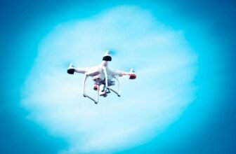
Weighing under 250 grams, these compact drones, like the DJI Mini series, fit easily in a jacket pocket or small camera bag. Their sub-250g weight exempts them from registration requirements in many countries, making them particularly travel-friendly. While they offer impressive image quality for their size (typically 12MP photos and 4K video), they have limitations in wind resistance and sensor size.
Mid-Range Travel Drones
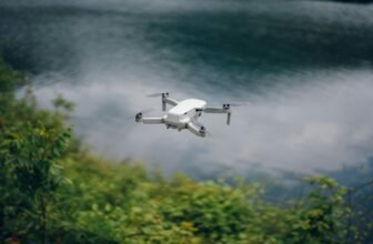
Models in the 300-800 gram range strike an excellent balance for serious travel photographers. They remain highly portable with folding designs that compress to the size of a water bottle. They offer superior cameras (often with 1-inch sensors), longer flight times (25-30 minutes), and better stability in moderate winds.
Professional Systems
For travelers whose primary purpose is photography, professional drone systems offer the highest image quality with advanced features like adjustable apertures, interchangeable lenses, and sophisticated obstacle avoidance. However, these benefits come with significant trade-offs in size, weight, and complexity—factors worth considering when packing for international travel.
Essential Accessories for Travel Drone Photography
Beyond the drone itself, several accessories can significantly enhance your travel drone photography experience:
- Multiple Batteries: Flight times typically range from 20 to 35 minutes, making extra batteries essential for extended shooting sessions at remarkable destinations.
- Multi-Battery Charging Hub: These allow you to charge multiple batteries sequentially overnight, ensuring you’re ready for each day’s adventures.
- ND Filters: Similar to sunglasses for your drone camera, Neutral Density filters reduce light entering the lens, allowing for proper exposure and motion blur effects even in bright conditions.
- Protective Case: A compact hard case protects your investment during transit while remaining manageable within your travel luggage.
- Spare Propellers and Basic Tools: Minor accidents happen, and having replacement parts can save your photographic opportunities.
- High-Speed Memory Cards: Minimum Class 10 or UHS-I-rated cards ensure your drone can write data quickly enough for high-resolution photos and 4K video.
Practical Considerations for Travelers
When traveling with drone equipment, several practical considerations can make the difference between successful aerial photography and frustration:
- Battery Safety: According to international air transportation regulations, lithium-polymer batteries must be carried in your carry-on luggage. Using specialized battery-safe bags provides additional protection.
- Weather Protection: While most modern drones offer some weather resistance, none are fully waterproof. A small waterproof bag protects your drone during sudden weather changes or boat transportation.
- Backup Systems: Consider how your drone integrates with other travel photography equipment. Can your mobile device or tablet used for drone control also be a backup if your main camera fails?
Mastering Drone Photography Techniques
Fundamental Flight Skills for Photographers
Before focusing on artistic techniques, mastering precise drone control is essential. Developing muscle memory for basic maneuvers creates the foundation for creative photography:
- Hover Stability: Practice maintaining a perfectly stable hover, crucial for sharp images and precise composition.
- Smooth Transitions: Work on gradual, cinematic movements between positions rather than abrupt changes that appear jarring in videos.
- Return-to-Home Confidence: Thoroughly understand your drone’s automated return functions for emergencies or low-battery conditions.
- Manual Exposure Control: Learn to adjust camera settings in response to changing light conditions without requiring the drone to return.
Composition Techniques Unique to Aerial Photography
Drone photography opens entirely new compositional possibilities that ground-based photographers rarely experience:
The Top-Down Perspective
A bird’s eye view reveals patterns, symmetry, and relationships invisible from the ground. This perspective works particularly well for:
- Geometric architectural features and urban planning
- Natural patterns in landscapes like river deltas or forest canopies
- Human activities viewed from above, such as markets or beach scenes
- Abstract compositions emphasizing texture and color
Revealing Scale and Context
Drones excel at capturing the relationship between landscapes and human elements, providing context impossible from ground level:
- Position your drone to show both impressive natural features and human elements that provide scale
- Include winding paths, roads, or rivers that lead the viewer’s eye through the landscape
- Contrast natural and human-made environments to tell more complete stories about destinations
Low-Altitude Advantages
Not all drone photography needs to be from extreme heights. Flying just 10-20 meters above ground level can provide unique perspectives while maintaining an intimate connection with subjects:
- Capture just enough elevation to show the layout of historical sites while preserving detail
- Follow coastlines, ridgelines, or urban corridors at modest altitudes for immersive perspectives
- Use low-altitude approaches to reveal hidden aspects of familiar landmarks
Lighting Considerations for Aerial Photography
Light behaves differently when photographing from above, requiring adaptation of traditional photography principles:
- Golden Hour Amplified: The warm, directional light of early morning and late afternoon creates dramatic shadows and textures when viewed from above, making these times even more valuable for drone photographers.
- Midday Opportunities: While generally challenging for ground-based photography, the overhead sun can create stunning top-down images with minimal shadows, revealing colors and patterns in water, fields, and urban environments.
- Shadow Play: Your drone’s shadow can distract from images. Position yourself and your drone with awareness of the sun’s angle to avoid unwanted shadows in your composition.
- Weather Transitions: Some of the most dramatic aerial images capture weather boundaries, storm fronts, or fog conditions that are difficult to appreciate from ground level.
Navigating Drone Regulations Worldwide
Understanding the Regulatory Landscape
Drone regulations vary significantly between countries and continue to evolve rapidly. Responsible travel photographers must research requirements before each trip:
Common Regulatory Elements
Despite variations, most national drone regulations address similar concerns:
- Registration Requirements: Many countries require drones above certain weights (often 250g) to be registered before flight.
- Pilot Certification: Some nations require a license or certificate of competency, particularly for drones over specific weight thresholds.
- Insurance Requirements: Certain countries mandate liability insurance coverage for drone operations.
- No-Fly Zones: Universal restrictions typically include airports, military facilities, government buildings, and critical infrastructure.
- Height Limitations: Maximum altitudes generally range from 120-400 feet (35-120 meters), depending on the country.
Resources for Travelers
Before traveling with your drone, consult these resources:
- Official civil aviation authority websites for your destinations
- Specialized apps like AirMap or UAV Forecast that aggregate regulations and restricted areas
- Online communities and forums where drone photographers share recent experiences
- Local drone clubs or photography groups at your destination
Cultural and Ethical Considerations
Beyond legal requirements, responsible drone photography requires sensitivity to local customs and privacy expectations:
- Research cultural attitudes toward photography and privacy at your destination
- Avoid flying over religious ceremonies, private gatherings, or culturally sensitive locations
- Consider how your drone’s noise might impact others’ experiences in natural settings
- When photographing people from above, seek permission or maintain a sufficient altitude to preserve anonymity.
Safety Protocols for Travel Drone Photography
Safety must remain the priority despite the excitement of capturing unique perspectives:
- Conduct thorough pre-flight checks before each session
- Maintain a visual line of sight with your drone at all times
- Monitor battery levels conservatively, planning a return with at least 30% power remaining
- Assess environmental risks, including wind conditions, obstacles, and wildlife
- Have a clear emergency protocol if something goes wrong
Post-Processing Your Aerial Images
Unique Challenges of Aerial Image Editing
Drone photographs present distinct post-processing challenges compared to ground-based images:
- Atmospheric Haze: Higher altitudes often introduce atmospheric haze that reduces contrast and clarity.
- Color Calibration: Drone cameras may render colors differently due to their unique sensors and viewing angles.
- Perspective Correction: Slight tilts or uneven horizons become more noticeable in aerial views.
- Dynamic Range: Extreme contrasts between bright skies and shadowed landscapes require careful balancing.
Essential Post-Processing Workflows
A systematic approach helps address these challenges:
Basic Adjustments
Begin with fundamental corrections to establish a solid foundation:
- Lens corrections to address distortion common in wide-angle drone lenses
- Horizon leveling to ensure properly aligned perspectives
- White balance adjustment to compensate for atmospheric conditions
- Exposure balancing to recover details in highlights and shadows
Creative Enhancements
After technical corrections, focus on creative aspects that enhance your travel story:
- Clarity and dehaze adjustments to cut through atmospheric interference
- Selective color adjustments to emphasize natural features like water or vegetation
- Gradient filters to balance exposure between bright skies and darker landscapes
- Subtle vignetting to direct viewer attention toward your main subject
Software Tools for Drone Photographers
Several software options offer specialized features for aerial image processing:
- Adobe Lightroom and Photoshop: Industry standards with powerful tools for general editing plus panorama stitching capabilities.
- DJI Photo: Purpose-built for drone imagery with automated corrections for common issues.
- Skylum Luminar: Features AI-powered tools specifically designed for landscape enhancement.
- PTGui or Autopano: Specialized panorama stitching software for creating ultra-wide aerial perspectives.
Creative Compositions from Above
Revealing Patterns and Symmetry
One of drone photography’s most compelling aspects is its ability to reveal natural and human-made patterns invisible from the ground:
- Natural Geometry: When viewed from above, rivers, coastlines, and geological formations often display mathematical patterns like fractals or flowing curves.
- Agricultural Landscapes: Farmlands create striking geometric compositions with their orderly arrangement of fields, irrigation systems, and varying crops.
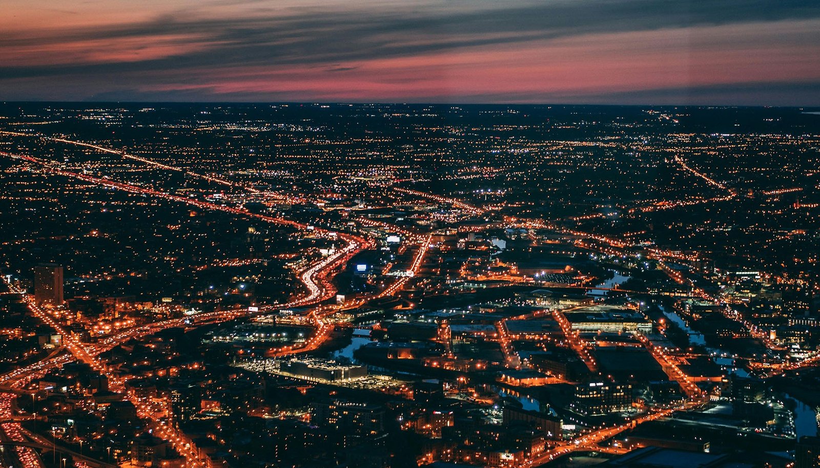
- Urban Planning: Cities reveal their underlying design principles from the air, whether it’s the grid system of Manhattan, the radial streets of Paris, or the organic growth patterns of ancient cities.
- Infrastructure Networks: Transportation systems, energy distribution, and water management create compelling visual stories about how humans interact with the landscape.
Capturing Environmental Stories
Drone photography offers unique opportunities to document environmental conditions and changes:
- Environmental Contrasts: Juxtapose natural and developed areas to highlight conservation challenges or successes.
- Seasonal Transitions: Return to locations throughout the year to document how landscapes transform with seasonal changes.
- Environmental Impacts: Respectfully document how human activities or natural events affect landscapes over time.
- Conservation Successes: Showcase protected areas, restoration projects, and sustainable development from perspectives that reveal their true scale and context.
Creative Techniques Beyond Still Photography
Modern drones offer capabilities extending beyond traditional still photography:
- Automated Panoramas: Create ultra-wide or 360-degree images using your drone’s automated panorama functions.
- HDR Imaging: Use exposure bracketing to capture high-dynamic-range scenes, such as sunrises over mountains or cityscapes at twilight.
- Hyperlapse Sequences: Combine drone movement with time-lapse techniques to create dynamic visual journeys through landscapes.
- Low-Light Performance: Experiment with dusk and dawn photography when colors are richest, and tourist crowds are minimal.
Planning Your Drone Travel Photography
Research and Pre-Visualization
Thorough preparation significantly increases your chances of capturing exceptional drone images:
- Location Scouting: Use Google Earth, Instagram geotags, and photography websites to identify promising locations before arrival.
- Sun Position Planning: Tools like PhotoPills or The Photographer’s Ephemeris help predict exactly where and when the light will be optimal for your chosen subjects.
- Permission Research: Identify locations requiring special permits or permission well before your trip.
- Weather Pattern Analysis: Research typical weather conditions for your destination by season and time of day.
Logistics for Drone Travelers
Practical planning aspects specific to drone photography:
- Battery Management: Calculate how many batteries you’ll need between charging opportunities based on planned shooting sessions.
- Storage Requirements: Estimate storage needs based on your typical shooting volume and the drone’s file sizes.
- Transportation Strategies: Plan how you’ll safely carry your drone during different transportation modes at your destination.
- Local Resource Identification: Research where you might find replacement parts or technical assistance if needed.
Integrating Drone Photography with Traditional Travel Photography
Consider how aerial images will complement your overall travel documentation:
- Establishing Shots: Use drone images to establish location context before showing details with ground-level photography.
- Before/After Perspectives: Attempt to capture identical compositions from ground level and then from the air to show different dimensions.
- Story Progression: Plan how drone imagery fits within your broader visual narrative of a destination.
Common Challenges and Solutions
Weather and Environmental Challenges
Natural conditions often present the greatest challenges for drone photographers:
- Wind Management: Learn your drone’s wind limitations and techniques for stable flight in gusty conditions.
- Changing Light: Develop strategies for rapidly adjusting exposure as clouds move or the sun’s position changes.
- Harsh Midday Sun: Use polarizing filters and HDR techniques to manage extreme contrast during midday shoots.
- Fog and Mist: Either embrace atmospheric conditions as creative elements or use post-processing techniques to enhance visibility.
Technical and Equipment Challenges
Preparation helps overcome common technical issues:
- Signal Interference: Identify potential sources of radio frequency interference and positioning strategies to maintain strong connections.
- Compass Calibration: Learn proper calibration procedures for different environments, particularly those near large metal structures or magnetic fields.
- Battery Performance: Understand how temperature affects battery life—cold conditions can significantly reduce flight time, while excessive heat may damage batteries. Store batteries at room temperature before flights and use warmers in cold climates.
- GPS Reliability: In areas with weak GPS signals, like urban canyons or remote locations, prepare alternative navigation strategies and exercise heightened vigilance.
- Memory Card Failures: Always format cards in-camera before sessions and carry multiple cards to prevent data loss.
People and Social Challenges
The human element of drone photography presents unique considerations:
- Drawing Unwanted Attention: In some locations, drone flying may attract crowds or scrutiny. Have a plan for managing onlookers safely.
- Communication Strategies: When working with others, establish clear hand signals for takeoff, landing, and emergencies.
- Handling Security Inquiries: If approached by officials, be prepared to explain your purpose politely and demonstrate your regulatory compliance.
- Managing Subject Expectations: If photographing events or specific subjects, clarify beforehand what can realistically be captured given the weather, regulations, and technical limitations.
Showcasing Your Drone Photography
Building a Cohesive Travel Story
Transform individual images into compelling travel narratives:
- Narrative Sequencing: Arrange images to guide viewers through your journey, using aerial perspectives to establish context before revealing details.
- Mixing Perspectives: Combine aerial views with ground-level images to create more immersive stories that engage viewers at multiple scales.
- Consistent Processing Style: Develop a signature visual approach that ties your drone images together while reflecting your artistic vision.
- Contextual Information: Include brief location details and interesting facts to enhance viewer appreciation of the perspectives you’ve captured.
Digital Sharing Platforms
Different platforms offer unique opportunities for sharing your aerial photography:
- Instagram and Visual Networks: Optimize square and vertical formats, use geotags strategically, and engage with drone photography communities.
- Dedicated Photography Sites: Platforms like 500px and Flickr provide communities that appreciate technical aspects and creative compositions.
- Personal Portfolio Websites: Create themed galleries that showcase your destinations or specific aerial techniques.
- Virtual Reality Integration: Consider 360-degree panoramas and VR-compatible formats that allow viewers to explore your aerial perspectives interactively.
Print and Physical Displays
Despite the digital nature of drone photography, physical presentations offer distinct advantages:
- Large Format Printing: Aerial images often contain intricate details that shine when printed at larger sizes.
- Multi-Image Displays: Create triptychs or grid displays that tell more complete stories of locations from various heights and angles.
- Creative Mounting Options: Consider metal prints for vibrant colors or acrylic mounts for images with dramatic skies and water elements.
- Travel Books and Albums: Design custom photo books that integrate your aerial perspectives with traditional travel documentation.
Future Trends in Travel Drone Photography
Emerging Technologies
Stay aware of innovations reshaping aerial travel photography:
- AI-Enhanced Image Processing: Machine learning algorithms increasingly help overcome traditional drone photography limitations like dynamic range and low-light performance.
- Advanced Tracking Systems: Sophisticated subject tracking enables more complex shots where drones autonomously follow subjects through landscapes.
- Drone Swarms: Multiple coordinated drones may soon capture simultaneous perspectives of dynamic events or expansive landscapes.
- Improved Sensor Technology: Continuous improvements in camera sensors are expanding the viable shooting hours and conditions for drone photography.
Sustainable and Responsible Innovation
The future of drone travel photography balances technological advancement with environmental responsibility:
- Quieter Drones: Manufacturers are developing less disruptive propulsion systems to minimize impact on sensitive environments and wildlife.
- Extended Flight Times: Improving battery technology enables more efficient shooting sessions with fewer battery changes and less weight.
- Biodegradable Materials: Some manufacturers are exploring eco-friendly components for drones designed for challenging environments.
- Conservation Applications: Travel photographers increasingly collaborate with researchers to use drone imagery for environmental monitoring and protection.
Skills Development
As the technology evolves, new skills become essential for travel drone photographers:
- Advanced Weather Prediction: Developing expertise in microclimate assessment helps maximize productive flying time.
- Specialized Post-Processing: Learning techniques specifically for aerial imagery enhances the unique qualities of drone photography.
- Regulatory Expertise: Staying current with evolving international regulations becomes a professional necessity.
- Cross-Platform Storytelling: Combining still photography, video, and interactive elements creates more engaging travel documentation.
Conclusion: Your Journey into the Skies
Drone photography represents one of the most significant evolutions in travel documentation since the invention of the camera. By mastering this technology, you can access perspectives that transform how you see and share the world’s most remarkable places.
Remember that the most compelling drone photography balances technical excellence with a storyful composition. Your unique perspective—literally and creatively—will distinguish your work in an increasingly crowded visual landscape.
As you embark on your aerial photography journey, approach each destination with respect for regulations and cultural sensitivities. The most successful drone travel photographers are ambassadors for the responsible use of this powerful technology.
With proper preparation, creative vision, and technical skill, your drone can become your most valuable travel companion—revealing hidden patterns, unexpected beauty, and profound connections that forever change how you and your audience experience the world.
About the Author: Max Rivera is an award-winning travel photographer specializing in aerial perspectives. With over a decade of experience documenting destinations across six continents, [Your Name] conducts workshops and creates resources to help travelers elevate their photography through drone technology.