Ultimate Drone Photography Guide for Travel Bloggers: Capture Stunning Aerial Content
Introduction: Why Drone Photography for Travel Blogging is Essential for Travel Content Creators
Let’s be real: We live in a visual world. With scrolling thumbs and attention spans shorter than a squirrel’s nap, drone photography for travel blogging, capturing stunning imagery is essential for any travel blogger. Enter drones—the little flying machines that transform an ordinary landscape into an extraordinary panorama.
Imagine showcasing sun-soaked beaches from above, winding mountain trails, or vibrant cityscapes that rival the best postcard you’ve ever received. Capturing these aerial perspectives gives travel content creators a significant advantage in today’s competitive digital landscape.
Recent social media engagement studies show that posts with unique aerial photography receive up to three times more interaction than standard travel photos. This isn’t just about getting more likes—it’s about creating memorable content that stands out in a crowded digital space.
In this comprehensive guide, we’ll explore the world of drone photography, specifically tailored for travel bloggers. It is filled with professional insights to help your content soar above the competition.
Table of Contents
- Best Drones for Travel Photography in 2025
- How to Pack Your Drone for International Travel
- Understanding Drone Regulations Worldwide
- Advanced Aerial Photography Techniques for Travel Bloggers
- Optimal Camera Settings for Breathtaking Drone Travel Photos
- Strategic Planning for Epic Drone Travel Shots
- Creative Perspectives: Unique Drone Angles for Travel Content
- Post-Processing: Editing Drone Photos and Videos for Maximum Impact
- Drone Safety: Essential Precautions for Travel Photographers
- Incorporating Aerial Footage into Compelling Travel Narratives
- Monetizing Your Drone Travel Content
- Future Trends in Travel Drone Photography
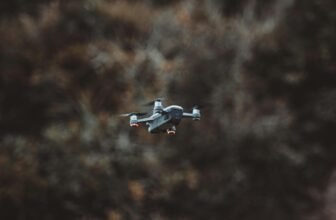
Best Drones for Travel Photography {#best-drones-for-travel-photography}
The drone market continues to evolve rapidly, offering increasingly sophisticated options for travel content creators. Your perfect match depends on your skill level, budget, and creative vision. Let’s explore the top contenders in 2025:
Professional-Grade Drones for Serious Travel Content Creators
DJI Mavic 3 Pro remains the gold standard for professional travel photographers. Its Hasselblad camera system captures stunning 5.1K video and 20MP still images with exceptional dynamic range. The 46-minute flight time allows you to capture the perfect shot, while its omnidirectional obstacle sensing provides peace of mind when flying in complex environments.
Key features that make it ideal for travel professionals:
- Four-Thirds CMOS sensor for superior image quality
- Variable aperture (f/2.8-f/11) for greater creative control
- Advanced Master Shots feature for automatic cinematic sequences
- O3+ video transmission with 15km range
- 8GB internal storage with expandable microSD support
Autel EVO Lite+ is an excellent alternative for professionals seeking something outside the DJI ecosystem. Its 6K video capabilities and 1-inch CMOS sensor produce images with remarkable clarity and color accuracy. The 40-minute flight time and robust wind resistance make it ideal for capturing dynamic travel scenes.
Mid-Range Options for Travel Bloggers
DJI Air 2S strikes an excellent balance between portability and performance. Its 1-inch sensor captures 5.4K video and 20MP photos with impressive detail, even in challenging lighting conditions. The Smart HDR feature automatically blends multiple exposures, which is ideal for high-contrast travel scenes like sunset cityscapes or mountain vistas.
Skydio 2+ excels in environments with complex obstacles. Its advanced AI-powered obstacle avoidance system makes it perfect for capturing dynamic travel moments—like following hikers through dense forests or tracking boats along winding rivers. While slightly bulkier than other options, its autonomous flight capabilities can capture unique perspectives that would be challenging for manual pilots.
Ultraportable Drones for Frequent Travelers
DJI Mini 3 Pro weighs under 250 grams (important for regulatory purposes in many countries) yet doesn’t compromise image quality. It captures 4K HDR video and features a camera that can rotate for vertical shooting—perfect for content creators focused on social media platforms like Instagram and TikTok.
Autel Nano+ offers another excellent sub-250g option with a 1/1.28-inch sensor capable of 4K video. Its 28-minute flight time and PDAF focusing system make it ideal for travel bloggers looking for exceptional portability without sacrificing image quality.
Budget-Friendly Options for Beginners
If you’re starting your drone photography journey, consider these more affordable options:
DJI Mini 2 SE provides an excellent entry point with 2.7K video capabilities and impressive stability for its price point. While lacking obstacle-avoidance sensors, it’s surprisingly wind-resistant and offers a respectable 31-minute flight time.
Holy Stone HS720E represents a solid non-DJI alternative with 4K camera capabilities, 23-minute flight time, and GPS-assisted hovering at a fraction of premium drone prices. While image quality won’t match higher-end models, it’s perfectly adequate for travel bloggers just beginning to explore aerial photography.
How to Pack Your Drone for International Travel {#packing-drone-for-international-travel}
Traveling internationally with a drone requires careful planning and organization. Follow this comprehensive packing strategy to ensure your equipment arrives safely and ready to capture amazing travel moments:
Essential Drone Packing Checklist
Before anything else, research your destination’s drone regulations. Some countries have strict rules about drone usage or may prohibit them entirely. Once you’ve confirmed you can legally fly, focus on proper packing:
- Invest in a dedicated drone case: A high-quality protective case like the Pelican 1535 Air Case or the more affordable PGYTECH OneMo Backpack provides customized foam compartments that prevent damage during rough handling.
- Battery management: Lithium batteries require special attention during air travel:
- Always carry drone batteries in your carry-on luggage (never in checked bags)
- Use LiPo battery safety bags to prevent short circuits
- Discharge batteries to approximately 60% before flying (reduces fire risk and preserves battery health)
- Check your airline’s specific limits on battery quantity and capacity (usually measured in Watt-hours)
- Protect delicate components:
- Remove propellers and store them separately
- Use lens filter cases for organizing and protecting ND filters
- Consider a gimbal lock or cover to prevent movement damage
- Use silica gel packets in your case to prevent moisture buildup
- Essential accessories and backups:
- Spare propellers (at least two sets)
- Extra memory cards (higher capacity than you think you’ll need)
- Portable charging hub and travel adapters for your destination
- Microfiber cleaning cloths and compressed air for dust removal
- Rain cover if you anticipate adverse weather conditions
- Tablet/phone sunshade for better screen visibility outdoors
Documentation Requirements
Carry these essential documents to avoid problems at customs or when flying your drone:
- Drone registration documentation (if registered in your home country)
- Proof of drone insurance (increasingly required in many destinations)
- Receipts/proof of purchase (helps establish ownership if questioned)
- A printed copy of drone regulations for your destination
- Any required permits for specific flying locations
Minimizing Weight While Maximizing Protection
For ultralight travel setups:
- Consider a flexible neoprene case instead of hard cases for smaller drones
- Use clothing as additional padding inside your regular travel bags
- Prioritize only the most essential accessories
- Combine drone equipment with other camera gear in a multi-purpose camera backpack
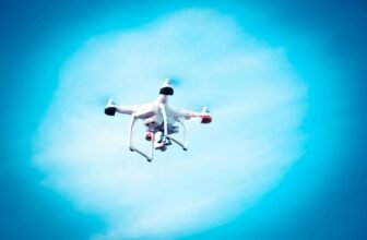
Understanding Drone Regulations Worldwide {#drone-regulations-worldwide}
Navigating the complex web of international drone regulations can be challenging, but compliance is essential to avoid fines, confiscation, or legal issues. Here’s a strategic approach to understanding and following drone laws while traveling:
Research Framework for Drone Regulations
Before flying to any new location, investigate these key regulatory aspects:
- Registration requirements: Many countries now require drone registration, even for temporary visitors. For example:
- USA: All drones over 250g must be registered with the FAA
- UK: Drones over 250g require operator registration with the CAA
- Japan: Drones over 100g must be registered with the MLIT
- Weight-based restrictions: Regulations often vary based on drone weight:
- Sub-250g drones face fewer restrictions in many jurisdictions
- Heavier drones may require special permits in certain areas
- No-fly zones: Common prohibited areas include:
- Airport proximity (typically 5km/3mi radius)
- Military installations and government buildings
- National parks and protected natural areas
- Crowded urban centers and public gatherings
- Critical infrastructure like power plants
- Permit requirements: Some destinations demand pre-approval:
- Morocco requires authorization from multiple government agencies
- India mandates that import permits be obtained before arrival
- Many European cities require specific urban flight permits
Regional Regulation Highlights
Europe
The European Union Aviation Safety Agency (EASA) has standardized drone regulations across member states, categorizing flights into:
- “Open” category: Lower-risk flights requiring no authorization
- “Specific” category: Medium-risk operations requiring declarations or authorizations
- “Certified” category: Higher-risk activities requiring certification
Even with this standardization, individual countries may have additional restrictions in specific locations.
Asia
Regulations vary dramatically across Asian countries:
- Japan: Relatively drone-friendly but prohibits flights in densely populated areas
- Thailand: Requires registration with the CAAT and has strict no-fly zones
- UAE: Extremely strict regulations with mandatory registration and potential for significant fines
Americas
- USA: Follows FAA regulations with restrictions near airports and national parks
- Mexico: Requires drone registration and prohibits flights near archaeological sites
- Costa Rica: Relatively relaxed for recreational use but enforces strict wildlife area restrictions
Using Technology to Stay Compliant
Take advantage of these tools to navigate regulatory complexities:
- B4UFLY (USA) and OpenSky (global): Mobile apps showing restricted airspace
- Airmap: Provides real-time airspace information and helps secure authorizations
- DJI GEO System: Built into many DJI drones to prevent flying in restricted zones
- UAV Forecast: Combines weather and regulatory information for flight planning
Advanced Aerial Photography Techniques for Travel Bloggers {#aerial-photography-techniques}
Elevate your drone travel photography beyond basic aerial snapshots with these professional techniques that create truly engaging visual content:
Mastering Drone Composition
The fundamentals of photographic composition apply to aerial photography but with unique considerations:
- Altitude variation: Experiment with different heights to find the optimal perspective:
- Low altitude (10-30m): Creates dramatic foreground-background relationships
- Medium altitude (30-80m): Ideal for contextual storytelling shots
- High altitude (80-120m): Reveals patterns and landscapes invisible from the ground
- Lines and patterns: Aerial photography excels at revealing:
- Leading lines: Roads, rivers, and shorelines that guide the viewer’s eye
- Natural patterns: Agricultural fields, dunes, or forest canopies
- Urban geometry: City grids, architectural features, and infrastructure networks
- Scale incorporation: Include recognizable elements to provide perspective:
- Vehicles or people (with permission) create instant scale reference
- Shadows at sunrise/sunset can dramatically enhance dimensional understanding
- The juxtaposition of natural and human-made elements tells a more complex story
Advanced Flight Techniques
Master these drone movements to capture dynamic travel content:
- Reveal shots: Start with the camera pointing downward, then slowly tilt up while flying forward to dramatically reveal a landscape
- Orbit movements: Circle around a subject while keeping it centered in the frame—perfect for showcasing landmarks or natural features
- Altitude shifts: Gradually ascending or descending while moving forward creates a powerful sense of scale and depth
- Tracking shots: Follow moving subjects like boats, vehicles, or hikers to add narrative momentum to your travel stories
Lighting Considerations for Drone Photography
Understanding light from an aerial perspective requires special attention:
- Golden and blue hours: The first and last hour of daylight offers:
- Longer, more dramatic shadows that emphasize texture and topography
- Warmer color temperature that enhances landscapes
- Reduced dynamic range that makes it easier for drone sensors to capture
- Midday strategies: When forced to shoot in harsh light:
- Use ND filters to maintain proper exposure settings
- Look for reflective surfaces like water bodies that benefit from overhead sun
- Consider converting to black and white to emphasize patterns over color
- Weather opportunities: Different conditions create unique aerial perspectives:
- Low-hanging clouds can create dramatic separation between landscape features
- Light fog adds mystery and depth to forest or urban scenes
- Post-rain conditions often feature enhanced colors and clarity
Due to their smaller sensors, drones are particularly susceptible to lighting challenges. Bracketing exposures (taking multiple shots at different exposures) provides flexibility during post-processing.
Optimal Camera Settings for Breathtaking Drone Travel Photos {#optimal-camera-settings}
Achieving professional-quality drone images requires understanding the unique technical considerations of aerial photography. Here’s how to optimize your drone’s camera settings for different travel scenarios:
Fundamental Camera Settings
- File format selection:
- Always shoot in RAW format when possible (DNG or proprietary RAW)
- If storage is limited, high-quality JPG + RAW for key shots provides flexibility
- For video, use the highest bitrate your memory cards can reliably handle
- Exposure triangle optimization:
- Aperture: If your drone has an adjustable aperture:
- f/4 to f/5.6 for most landscape shots (balances sharpness and light gathering)
- f/2.8 for low-light situations where depth of field is less critical
- f/8 to f/11 for maximum depth of field in bright conditions
- Shutter speed:
- For still photos: Minimum 1/[focal length equivalent] to prevent blur
- For videos: Follow the 180° shutter rule (shutter speed = 2 × frame rate)
- For intentional motion blur, 1/15 to 1/30 seconds can create artistic light trails
- ISO sensitivity:
- Keep as low as possible (ideally 100-400)
- Most drone sensors show noticeable quality degradation above ISO 800
- It is better to underexpose and recover in post than use high ISO slightly
- Aperture: If your drone has an adjustable aperture:
- White balance considerations:
- Auto white balance works well in most situations
- For sunrise/sunset, manually set to “cloudy” for warmer tones
- For consistent image sequences, use a fixed Kelvin setting
Advanced Settings for Specific Travel Scenarios
- Beach and water photography:
- Polarizing filter to reduce glare and enhance underwater visibility
- Slightly faster shutter speeds (1/500+) to freeze wave motion
- Exposure compensation of -0.7 to -1.0 to prevent highlight clipping on bright sand/water
- Mountain and landscape photography:
- ND gradient filters (physical or in the post) to balance bright skies with darker terrain
- Focus stacking techniques for ultra-sharp foreground-to-background detail
- AEB (Auto Exposure Bracketing) for high dynamic range scenes
- Urban and architectural photography:
- Enable lens correction to minimize distortion of straight lines
- Grid overlay for perfect alignment of buildings and streets
- Higher contrast picture profile to emphasize architectural details
- Night and low-light photography:
- Slower shutter speeds (requiring a hovering drone with excellent stabilization)
- Noise-reduction settings balanced against detail preservation
- Consider interval shooting for star trails or light painting effects
Using ND Filters Effectively
Neutral Density filters are essential tools for drone photographers:
- ND4 (2 stops): Ideal for slightly overcast days
- ND8-ND16 (3-4 stops): Perfect for normal daylight conditions
- ND32-ND64 (5-6 stops): For very bright conditions or creative long exposures
- Variable ND: Convenient, but watch for cross-polarization patterns at extreme settings
High-quality filter systems like PolarPro or Moment provide better color neutrality and edge sharpness than budget options. For travel convenience, consider a filter case that attaches directly to your drone case.
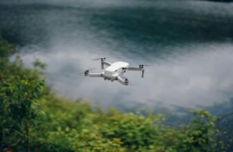
Strategic Planning for Epic Drone Travel Shots {#planning-drone-shots}
Preparation significantly increases your chances of capturing exceptional drone travel content. Develop a methodical approach to planning that maximizes limited flight time and battery life:
Pre-Trip Planning Essentials
- Location scouting from afar:
- Use Google Earth’s 3D view to preview potential shooting locations
- Apps like SunSeeker or PhotoPills help predict lighting conditions
- Study other photographers’ drone work from your destination on platforms like Instagram or 500px
- Map out restricted airspace using AirMap or similar services before arriving
- Creating a detailed shot list:
- Prioritize shots based on weather dependency and lighting requirements
- Group nearby locations to minimize travel and setup time
- Plan alternate compositions for each location in case of unexpected restrictions
- Include specific flight patterns and camera movements for dynamic video sequences
- Weather planning strategies:
- Schedule your most important shots during predicted optimal conditions
- Build flexibility into your itinerary to adapt to changing weather
- Research seasonal particularities of your destination (monsoon seasons, fog patterns, etc).
- Remember that conditions at altitude often differ from ground level
On-Location Workflow
Develop an efficient system for maximizing productivity once you’re at your shooting location:
- Site assessment protocol:
- Identify potential takeoff/landing zones with clear sight lines
- Note physical obstacles like trees, power lines, or buildings
- Check for interference sources that might affect radio signals
- Verify wind conditions at various altitudes (often stronger higher up)
- Shot execution framework:
- Start with a low “scouting flight” to confirm safe paths and interesting angles
- Capture establishing wide shots before moving to detailed compositions
- Work from higher to lower altitudes as batteries drain (easier emergency landing)
- Shoot panorama sequences early in the flight when gimbal calibration is freshest
- Backup and review process:
- Review key footage before leaving the location to ensure quality
- Back up memory cards daily to multiple devices
- Keep notes on successful techniques and challenges for future reference
- Tag locations with GPS coordinates for potential return visits
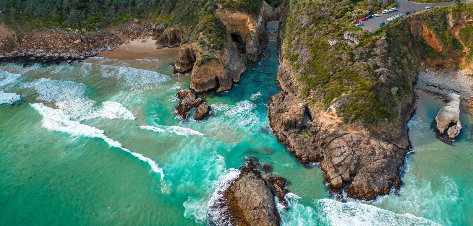
Creative Perspectives: Unique Drone Angles for Travel Content {#unique-drone-perspectives}
The true power of drone photography lies in capturing perspectives that are impossible to capture through conventional photography. Master these distinctive viewpoints to create truly memorable travel content:
Top-Down (Nadir) Photography
This straight-down perspective reveals patterns and symmetry invisible from the ground:
- Pattern discovery applications:
- Agricultural landscapes with geometric field divisions
- Coastal areas where land meets water in intricate patterns
- Urban plazas and architectural features with symmetrical designs
- Natural formations like river deltas or geological structures
- Technical considerations:
- Disable gimbal horizon leveling for true 90° down shots
- Use a higher altitude to minimize perspective distortion
- Consider square cropping to emphasize symmetrical subjects
- Experiment with centered vs. off-center compositions
Angled Perspectives (30-45°)
This versatile angle combines depth and context:
- Storytelling opportunities:
- Show relationships between landscape elements (mountains to valleys, cities to surrounding nature)
- Reveal the scale of architectural structures alongside human elements
- Capturing the flow of transportation networks through environments
- Demonstrate how natural features like rivers shape human settlements
- Composition techniques:
- Use the rule of thirds to position horizon lines advantageously
- Create depth through layering (foreground, middle ground, background)
- Include leading lines that guide the viewer through the image
- Frame important elements with natural borders
Dynamic Movement Shots
Incorporate motion to elevate your travel storytelling:
- Reveal techniques:
- Begin focusing on a detail, then pull back to reveal the broader context
- Start behind an obstacle, then rise to unveil the landscape beyond
- Track along a natural feature (coastline, mountain ridge) before revealing the destination
- Subject tracking approaches:
- Follow moving elements like boats, trains, or wildlife for narrative continuity
- Create parallax effects by moving laterally past foreground elements
- Execute slow, steady orbits around prominent landmarks
- Combining vertical and horizontal movements for dynamic reveals
Aerial Timelapse and Hyperlapse
These advanced techniques compress time to show environmental changes:
- Stationary time-lapse applications:
- Capture changing light conditions during sunrise/sunset
- Show tidal patterns in coastal environments
- Document cloud formations and movements over landscapes
- Record urban activity patterns from above
- Moving hyper-lapse techniques:
- Program waypoints for consistent movement between frames
- Use interval shooting combined with slow drone movement
- Create orbit hyper-lapses around significant structures
- Develop altitude-change hyper-lapses from ground to aerial perspective
Post-Processing: Editing Drone Photos and Videos for Maximum Impact {#editing-drone-content}
Effective post-processing transforms good drone footage into compelling travel content. Develop a systematic editing workflow that enhances your aerial imagery while maintaining authenticity:
Photo Editing Workflow
- Organizational systems:
- Import and keyword your footage immediately after shooting
- Flag and rate your best images for efficient workflow
- Group-related shots for consistency in batch editing
- Maintain separate catalogs for different destinations or trips
- Essential adjustments for drone photography:
- Lens corrections: Remove distortion and vignetting inherent in drone lenses
- Perspective adjustments: Fine-tune horizon lines and vertical perspectives
- Color calibration: Compensate for atmospheric haze that affects aerial shots
- Selective adjustments: Use radial or graduated filters to direct attention
- Software recommendations for drone photos:
- Adobe Lightroom: Excellent all-around solution with powerful organization
- Capture One: Superior color grading for professional outputs
- DxO PhotoLab: Unmatched noise reduction for challenging lighting conditions
- Luminar AI: Quick atmospheric enhancements with AI assistance
Video Editing Strategies
- Assembly techniques:
- Create a select reel of your best clips before building the timeline
- Establish a consistent pace that matches your destination’s character
- Incorporate ground-level footage to provide context for aerial perspectives
- Balance wide establishing shots with more intimate details
- Color grading for aerial footage:
- Develop destination-specific color palettes that evoke emotional responses
- Correct the blue color cast often present in high-altitude footage
- Use LUTs (Look-Up Tables) designed specifically for drone sensors
- Maintain consistency across clips shot at different times of day
- Recommended video editing platforms:
- Adobe Premiere Pro: Industry standard with extensive plugin support
- Final Cut Pro: Optimized performance on Mac systems
- DaVinci Resolve: Superior color grading capabilities, with a free version available
- LumaFusion: Powerful mobile editing for on-the-road processing
- Audio considerations:
- Replace the drone’s propeller noise with atmospheric sounds or music
- Consider recording ambient audio from ground level to layer with aerial footage
- Match the sound design to the rhythm and mood of your visual sequences
- License appropriate music that enhances rather than overwhelms your content
Drone Safety: Essential Precautions for Travel Photographers {#drone-safety-precautions}
Safety must remain the top priority for travel drone photographers. Responsible operation protects people, property, and wildlife and ensures the continued accessibility of drones for creative purposes:
Pre-Flight Safety Protocol
- Environmental assessment:
- Check weather conditions with special attention to wind speed and gusts
- Identify potential hazards like power lines, trees, or radio towers
- Assess the terrain for suitable takeoff and landing zones
- Note the position of the sun to avoid direct glare affecting visibility
- Equipment inspection checklist:
- Examine propellers for damage or debris
- Verify battery health and secure attachment
- Confirm stable GPS signal acquisition
- Test control responsiveness before a full flight
- Calibrate compass and IMU when in new locations
- Flight planning safety elements:
- Set appropriate return-to-home altitude above obstacles
- Define geofence boundaries to prevent flyaways
- Plan battery usage with a 20% emergency reserve
- Prepare for contingencies like loss of signal or sudden weather changes
During Flight Safety Practices
- Situational awareness maintenance:
- Keep the drone within the visual line of sight
- Continuously scan for birds or other aircraft
- Monitor battery levels and distance from the home point
- Be aware of changing weather conditions
- Responsible operation guidelines:
- Maintain a safe distance from people and private property
- Fly at reasonable speeds that allow time to react
- Avoid wildlife disturbance, especially during nesting seasons
- Respect privacy by not hovering near windows or private spaces
- Emergency response preparation:
- Know how to trigger the return-to-home function
- Practice emergency landing procedures
- Understand when to sacrifice the drone to prevent injury
- Carry a drone retrieval kit for unexpected landings
Incorporating Aerial Footage into Compelling Travel Narratives {#incorporating-drone-footage}
Transform your drone content from isolated, beautiful shots into powerful storytelling elements that enhance your travel narrative:
Structural Integration Approaches
- Opening with impact:
- Use dramatic aerial reveals to establish location context
- Create curiosity by showing unusual patterns or perspectives
- Establish an emotional tone through carefully selected aerial compositions
- Combine drone footage with text overlays for powerful introductions
- Narrative progression techniques:
- Use aerial transitions between locations to maintain geographical clarity
- Show the relationship between destinations through top-down map-like perspectives
- Create visual metaphors through carefully selected aerial compositions
- Develop recurring aerial motifs that reinforce your destination’s character
- Complementary ground-drone pairings:
- Match aerial wide shots with ground-level details of the same subject
- Create continuity by tracking subjects from the ground to the air
- Use contrasting perspectives to highlight scale and context
- Develop sequence progressions from intimate to expansive views
Platform-Specific Optimization
- Blog integration strategies:
- Embed interactive 360° panoramas created from drone stills
- Pair aerial images with maps to provide geographical context
- Create before/after sliders comparing ground and aerial perspectives
- Develop clickable image galleries organized by drone perspective type
- Social media format considerations:
- Instagram: Create carousel posts pairing aerial with ground perspectives
- YouTube: Design thumbnails featuring dramatic aerial compositions
- Facebook: Optimize aspect ratios for improved news feed visibility
- TikTok/Reels: Utilize quick aerial reveals for attention-grabbing openings
- Multi-platform content architecture:
- Repurpose drone footage across platforms with format-specific edits
- Create teaser clips from longer aerial sequences for social promotion
- Develop platform-appropriate narrative structures around the same drone assets
- Use consistent color grading across platforms for brand recognition
Monetizing Your Drone Travel Content {#monetizing-drone-content}
Convert your aerial photography skills into revenue streams that support your continued travel and content creation:
Direct Income Opportunities
- Stock footage and photography:
- Submit high-quality drone content to platforms like Shutterstock, Adobe Stock, and Pond5
- Focus on unique perspectives of popular destinations
- Create collections of related content for better searchability
- Target commercial categories with higher licensing values
- Client-based drone services:
- Offer location scouting services for production companies
- Create custom aerial content for tourism boards and hospitality businesses
- Provide real estate aerial photography for luxury properties
- Develop partnerships with wedding and event photographers
- Educational products:
- Create drone photography masterclasses or tutorials
- Develop destination-specific drone guides with flight locations
- Offer one-on-one mentoring for aspiring aerial photographers
- Design presets and LUTs specifically for drone footage
Content Monetization Strategies
- Sponsored content opportunities:
- Partner with drone manufacturers for equipment reviews
- Collaborate with tourism destinations for featured content
- Create sponsored tutorials highlighting specific gear or techniques
- Develop brand partnerships with travel-related companies
- Membership and subscription models:
- Offer exclusive behind-the-scenes content showing drone techniques
- Provide downloadable flight plans for popular destinations
- Create members-only presets and editing tutorials
- Develop a community platform for drone travel photographers
- Physical products from drone content:
- Sell fine art prints of your most striking aerial images
- Create coffee table books featuring aerial perspectives
- Develop calendars organized by destination or perspective type
- Design smartphone cases and accessories featuring drone photography
Future Trends in Travel Drone Photography {#future-trends}
Stay ahead of the curve by anticipating and adapting to emerging developments in drone technology and creative approaches:
Technological Advancements
- Sensor evolution impact:
- Larger sensors enabling better low-light performance
- Increased dynamic range for challenging lighting conditions
- Higher resolution capabilities for more detailed captures
- Computational photography features like focus stacking and HDR
- AI and automation developments:
- Advanced subject tracking with predictive movement
- Automatic obstacle avoidance, enabling complex flight paths
- AI-powered shot suggestions based on location analysis
- Automated editing systems for quick content turnaround
- Next-generation drone capabilities:
- Extended flight times through battery technology improvements
- Enhanced stability in challenging weather conditions
- The quieter operation allows for less intrusive filming
- Improved portability through folding and modular designs
Creative Direction Evolution
- Immersive storytelling integration:
- 360° aerial video becoming standard for virtual travel experiences
- AR overlays combining drone footage with interactive information
- FPV-style dynamic movements entering mainstream travel content
- Cross-platform narrative experiences utilizing aerial perspectives
- Ethical and sustainable approaches:
- Increased emphasis on wildlife-friendly drone practices
- Growing focus on cultural sensitivity in drone documentation
- Development of quieter, less intrusive drone technology
- Use of drones to document environmental changes and conservation efforts
- Community and collaboration trends:
- Crowdsourced drone mapping of changing destinations
- Collaborative projects documenting global themes from above
- Standardization of drone photography ethics and best practices
- Increased education about responsible drone travel photography
Conclusion: Elevating Your Travel Content Through Drone Mastery
Drone photography has revolutionized travel content creation, offering perspectives that were once available only to those with helicopter budgets. By mastering the technical, creative, and strategic aspects of aerial imaging, you position yourself at the forefront of travel storytelling.
Remember that the most compelling drone photography transcends mere pretty pictures—it reveals new insights about destinations, creates emotional connections with viewers, and tells stories that are impossible to capture from the ground. As drone technology evolves, the creative possibilities will only expand for travel content creators willing to invest time in developing their aerial imaging skills.
Whether you’re capturing the intricate patterns of a bustling market from above, revealing the true scale of a mountain landscape, or discovering hidden gems invisible from ground level, your drone is more than a flying camera—it’s a powerful storytelling tool that can elevate your travel content.
So, charge those batteries, check local regulations, and prepare for takeoff. The world looks different from above, and your audience is waiting to see it through your unique aerial perspective.