Consumer drones have revolutionized aerial drone travel photography, allowing adventurers to capture stunning perspectives previously accessible only to professional photographers with helicopters or planes. Whether you’re documenting majestic landscapes, ancient architecture, or vibrant cityscapes, aerial photography adds a compelling dimension to your travel memories. This comprehensive guide will walk you through everything you need to know about capturing breathtaking drone photography on your next adventure.
Why Drone Photography Elevates Your Travel Experience
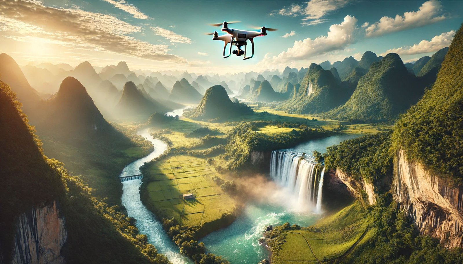
Drone photography doesn’t just result in spectacular images—it changes how you experience destinations. From above, patterns emerge that aren’t visible from the ground: the geometric precision of terraced rice fields in Bali, the winding paths of medieval European towns, or the dramatic meeting point of desert and ocean along coastlines.
Aerial perspectives reveal landmarks’ true scale and context. The sprawling majesty of Angkor Wat, the intricate layout of Santorini’s whitewashed buildings cascading toward the sea, or the perfect symmetry of gardens surrounding the Taj Mahal all take on new meaning when viewed from above.
Beyond the images themselves, drone photography encourages exploration beyond typical tourist spots. You’ll find yourself seeking out unique vantage points and discovering hidden gems that most travelers miss.
Essential Equipment for Travel Drone Photography
Choosing the Right Drone
When selecting a drone for travel, consider these key factors:
- Portability: Foldable drones like the DJI Mini series or Air series strike an excellent balance between image quality and packability. Their compact design makes them ideal travel companions.
- Camera quality: Look for at least a 1/2.3-inch sensor with 12MP resolution, though 1-inch sensors offer significantly better quality, especially in challenging lighting conditions.
- Flight time: Longer battery life means more opportunities to capture the perfect shot. Most modern travel drones offer 25-35 minutes of flight time per battery.
- Smart features: Automated flight modes like orbit, dronie (selfie drone), and waypoints make complex shots easier to execute, especially for solo travelers.
- Wind resistance: If you’re heading to coastal areas or mountainous regions, choose a drone with good wind resistance ratings.
Must-Have Accessories
To ensure successful drone photography during travel, pack these essentials:
- Extra batteries: At minimum, carry three batteries to maximize shooting opportunities.
- Multi-battery charging hub: These allow you to charge multiple batteries simultaneously overnight.
- ND filters are equivalent to sunglasses for your drone camera. They allow proper exposure in bright conditions and create motion blur effects with water and clouds.
- Protective case: A hard-shell case protects your investment during transit.
- Spare propellers and basic tools: Accidents happen, and having replacements can save your photography plans.
- Portable power bank: This is for recharging batteries when away from power outlets.
- Tablet or phone hood shields your screen from glare, making it easier to compose shots in bright sunlight.
Pre-Trip Planning for Drone Photographers
Researching Drone Laws and Regulations
Before packing your drone, research the specific regulations of your destination:
- Country-specific regulations: Some countries like Cuba, Egypt, and Morocco have strict drone restrictions or outright bans. Others require prior registration or permits.
- No-fly zones: These typically include airports, military installations, government buildings, and many national parks. Apps like B4UFLY, AirMap, or UAV Forecast provide up-to-date information about restricted airspace.
- Registration requirements: Many countries require visitors to register their drones before flying. Some may even require temporary licenses.
- Insurance requirements: Some destinations require proof of liability insurance for drone operations.
- Import regulations: Certain countries may require customs declarations or temporary import permits for drones.
Discovering Optimal Drone Photography Locations
To find the best aerial photography opportunities:
- Search drone photography hashtags: Platforms like Instagram (#dronephotography, #fromwhere) and websites like Dronestagram showcase locations with dramatic aerial potential.
- Study satellite imagery: Google Earth previews locations from above, helping you identify interesting patterns, textures, and compositions.
- Join drone communities: Websites like DJI Forum and Facebook groups dedicated to drone photography often share location tips and advice.
- Plan for optimal timing: Research sunrise/sunset times and typical weather patterns for your destination to capture the most dramatic lighting conditions.
Mastering Drone Photography Techniques
Composition Principles for Aerial Photography
While traditional photography rules apply, aerial photography introduces unique compositional opportunities:
- Symmetry and patterns: From above, natural and human-made patterns become prominent. Look for symmetrical layouts in architecture, agricultural fields, and natural formations.
- Leading lines: Roads, rivers, and shorelines create powerful leading lines that draw viewers into your image.
- Negative space: The sky, open water, or uniform terrain can create compelling negative space that emphasizes your subject.
- Scale and context: Include scale elements—boats on water, cars on roads, or people on beaches- to help viewers comprehend the magnitude of landscapes.
- Layering: Capture different elevations and textures to create visual layers within your composition.
Camera Settings for Optimal Results
To achieve professional-quality aerial images:
- Shoot in RAW format: This preserves maximum information for post-processing flexibility.
- Use AEB (Auto Exposure Bracketing): This captures multiple exposures that can be combined later to handle challenging lighting conditions.
- Manual exposure settings: In challenging light, use manual settings:
- Set the ISO as low as possible (typically 100-200) to minimize noise
- Adjust the aperture for depth of field (typically f/2.8-f/4 for most drone cameras)
- Control shutter speed based on lighting conditions and desired motion effects
- White balance considerations: Auto white balance works well in most situations, but manual adjustment should be considered for sunrise/sunset or unusual lighting conditions.
- Focus settings: Set focus to infinity for landscapes, and use the tap-to-focus feature for subjects like buildings or people.
Advanced Flight Techniques for Creative Shots
Elevate your photography with these drone maneuvers:
- Reveal shots: Start with the camera pointing down, then gradually tilt up while flying forward to reveal landscapes dramatically.
- Orbit moves: Circle around a subject while keeping it centered in the frame to create dynamic perspective shifts.
- Altitude shifts: Gradually ascending or descending while moving forward creates a three-dimensional landscape experience.
- Top-down perspectives: Perfect 90-degree downward angles reveal patterns invisible from other perspectives.
- Panoramas: Both horizontal and vertical panoramas (created by stitching multiple images) capture expansive scenes beyond the capacity of a single frame.
Practical Tips for Field Operations
Pre-Flight Checklist
Before every flight, follow this essential checklist:
- Area assessment: Scout for obstacles, particularly power lines, which can be difficult to see on your controller screen.
- Wind and weather check: Verify that conditions are within your drone’s operational limits.
- Positioning optimization: Find a take-off location with a clear line-of-sight to your intended flight area.
- GPS signal verification: Ensure a strong GPS lock before takeoff.
- Return-to-home point configuration: Set and verify your RTH point and altitude.
- Battery and storage check: Confirm sufficient battery charge and memory card space.
- Obstacle avoidance settings: Enable appropriate sensors for your environment.
Safe and Respectful Flying Practices
Responsible drone operation preserves both your equipment and access to drone photography:
- Maintain visual line-of-sight: Always keep your drone visible.
- Respect privacy: Avoid flying over private property or photographing people without permission.
- Wildlife consideration: Keep a significant distance from wildlife to prevent disturbance.
- Awareness of surroundings: Be vigilant about changing conditions and unexpected obstacles.
- Time and noise sensitivity: Avoid flying early morning or late evening in populated areas.
- Backup safety features: Know how to activate return-to-home and emergency landing procedures.
- Local etiquette: Research cultural sensitivities regarding photography and technology.
Post-Processing for Stunning Results
Essential Editing Steps
Transform good drone photos into spectacular images with these editing techniques:
- Straighten and crop: Correct any horizon tilt and refine composition.
- Exposure adjustment: Recover details from shadows and highlights, which is particularly important in high-contrast aerial scenes.
- Color calibration: Adjust temperature and tint to represent the scene or create a specific mood accurately.
- Contrast and clarity: Enhance texture and definition, which is particularly important for landscape details viewed from above.
- Graduated filters: Balance exposure between bright skies and darker ground elements.
- Selective adjustments: Draw attention to specific areas through targeted enhancements.
Software Recommendations
These tools excel at handling drone photography:
- Adobe Lightroom: Industry standard for organizing and processing RAW files with powerful adjustment tools.
- DJI Photo: Free software designed for drone imagery with automated enhancement options.
- Skylum Luminar: Features AI-powered tools that are particularly effective for landscape enhancement.
- Affinity Photo: Cost-effective alternative to Photoshop with comprehensive editing capabilities.
- Snapseed (mobile): Powerful mobile editing app for quick adjustments when traveling.
Overcoming Common Challenges
Managing Difficult Lighting Conditions
Aerial photography often involves challenging light:
- Harsh midday sun: Use ND filters, slightly underexpose to preserve highlights, and consider bracketing exposures.
- In low-light situations, Increase ISO cautiously, use slower shutter speeds with stable hovering, and leverage image stabilization in post-processing.
- Backlit scenes: Position your drone to minimize direct sun in the frame or use it creatively for silhouettes and lens flare effects.
- Dynamic range limitations: Bracket exposures when scenes contain bright and dark elements.
Dealing with Technical Limitations
Work around common technical constraints:
- Battery life optimization: Fly purposefully, plan shots in advance, and keep batteries temperature-regulated in extreme climates.
- Signal interference: In urban environments, maintain closer distances and optimal antenna positioning.
- Limited onboard storage: Carry multiple high-speed memory cards and consider a portable backup solution.
- Adverse weather: Use weather apps to predict optimal flying windows and protect equipment when conditions change.
Sharing and Showcasing Your Aerial Travel Photography
Building a Compelling Portfolio
Create a cohesive collection of your best work:
- Thematic organization: Group images by destination, landscape type, or visual style.
- Quality over quantity: Showcase only your strongest images that tell unique stories.
- Diverse perspectives: Include a mix of altitudes, angles, and compositions.
- Context provision: Pair aerial views with ground-level shots to create complete visual narratives.
Platforms for Drone Photography
Share your work on platforms that appreciate aerial imagery:
- Specialized communities: SkyPixel, Dronestagram, and Droners.io focus specifically on aerial imagery.
- Broader photography sites: 500px, Flickr, and Behance attract photography enthusiasts interested in innovative perspectives.
- Social media optimization: Relevant hashtags (#dronephotography, #aerialview, #droneoftheday) help Instagram, Facebook, and Twitter reach wider audiences.
- Location tagging: When legal and appropriate, tagging locations helps interested viewers find your work.
Conclusion: The Future of Travel Drone Photography
Drone photography has transformed from novelty to an essential travel photography tool, offering perspectives that reshape how we experience and remember destinations. As technology advances, we can expect even more compact drones with better cameras, longer flight times, and smarter autonomous features.
The accessibility of aerial photography has democratized this once-exclusive perspective, allowing travelers to document our world’s beauty from above and share these unique visions globally. Whether you capture the geometric precision of ancient architecture, the organic flow of natural landscapes, or the vibrant energy of cities from above, drone photography adds an unforgettable dimension to travel documentation.
Combining technical knowledge, creative vision, and responsible operation allows you to create extraordinary aerial imagery that transforms your travel memories and inspires others to see familiar destinations in entirely new ways. The sky is no longer the limit—it’s your latest creative canvas.